The Yukon River, some 1,980 miles long, has its headwaters less than 20 miles from tidewater.
This is not normal for big rivers. You cannot point to another major river on the planet with the same claim.
How did that happen?
Well, it’s complicated. It took multiple glaciations, the eruption of an entire volcanic range, the geologically recent creation of the Alaska coastal mountain ranges and multiple glacial lakes to create the modern upper Yukon River drainage.
The Wrangell Mountains in southcentral Alaska are a volcanic range. They sit on the Wrangellia Terrane, which arrived 85 million years ago, but the Wrangell Volcanoes, the vast bulk of volcanoes are a delayed consequence of the much later arrival of the Yakutat Terrane. Most of the volcanoes are Pilocene or more recent. As the volcanoes rose up, they reduced the amount of moisture from the Pacific Ocean reaching Interior Alaska. It’s the same effect the the Cascade Mountains and Sierra Nevada have on points east of them: they create a rain shadow, where there is much less precipitation. The volcanoes also reduce the amount of warmer air reaching the interior, cutting off the air flow from the Pacific. So, the creation of the Wrangell volcanoes made the Yukon River drainage colder and a little drier. Glaciers running down the northerly side could descend lower without melting.
The arrival of the Chugach Terrane earlier had begin the process, but as the Chugach and St. Elias Mountains were shoved up higher by the accretion of terranes, they also made the Yukon River drainage colder and drier. They also helped create glaciation on their slopes. Snow is less likely to melt at higher elevations. Bigger ice fields; longer north descending glaciers.
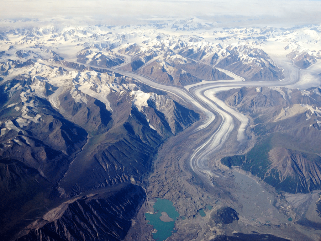
Glaciation is more complicated. There are three types of large scale glaciation: montane, cordilleran and continental. Montane glaciation is ice confined to mountains and mountain valleys. Think of the glaciers on and around Denali. Cordilleran glaciers are larger scale glaciers, usually driven by montane glaciation spilling out of the mountains down on the flatlands. Think of piedmont glaciers like Malaspina Glacier and Bering Glacier, where multiple montane glaciers combined and create a giant, relatively flat and very large area of ice on the southern shore of southcentral Alaska. Continental glaciers are what you probably think of when you say “ice age.” Vast sheets of ice covering the northern half of North America, for example. In reality, the most recent “ice age,” at least in Alaska and western Canada, involved at least five episodes of widespread glaciation involving at various times all three types of glaciation.
WC has complained previously about the lies WC was taught in public schools. One of those lies was that glaciation didn’t touch Interior Alaska. There was no continental glaciation in the Interior, but there was montane glaciation as close as the White Mountains north Fairbanks. If you’ve been to Eagle Summit, the signs of glaciation are pretty obvious. Cordilleran glaciation dammed the Tanana River at Cathedral Bluffs; that lake ended up draining eastwards into what’s now the White River. That contributed to alteration of streamflow on the north side of the St. Elias Mountains.
Other cordilleran glaciation carved out Kluane Lake and the dozens of glacial trench lakes like Bennett, Atlin and Leberge. Cordilleran Glaciers in the McKenzie Mountains dammed the flow of north flowing streams. The glacial lakes created overflowed the hills to the west and carved Whitehorse Rapids. When the ice finally all melted, the Yukon River, originally ending near the Alaska border, had captured the southern streams that had formerly drained into the McKenzie River.
The McKenzie was shoved eastwards and, except for a few small streams out of the McKenzie Mountains, was fed by glacial lakes to the east.
All of which is why the Yukon River’s headwaters are a short eagle’s flight from the end of Lynn Canal and the Pacific Ocean. There are other amazing aspects to Alaska’s biggest river; WC will try to get to them in future posts.


You must be logged in to post a comment.